Home
World
NEW
Premium
Shop
Trails
Articles
Help and support
Français
English
Nederlands
Español
Italiano
Deutsch
Log in
Home
World
Premium
Shop
Trails
Articles
Help and support
SityTrail
>
Points of interest
>
GC11465
SityTrail
>
Points of interest
>
GC11465
GC11465
Description
Le Galurin oublié by Bernours0
Photos
GC11465 can be discovered in the following trails...
tracegps
Crêt Coquet
Walking
Medium
(3)
Hautecour, Auvergne-Rhône-Alpes, Savoy, France
6.5 km | 9.6 km-effort
3h 30min
Yes
tracegps
User
©
OpenStreetMap
contributors
Positioning
Country:
France
Region :
Provence-Alpes-Côte d'Azur
Department/Province :
Hautes-Alpes
Municipality :
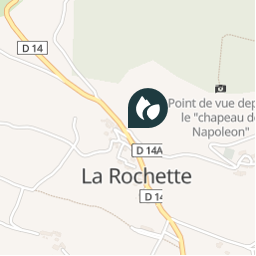
La Rochette
Location:
Unknown
Positioning
44.595883 / 6.15085
Creation date :
2018-04-09 12:15:19.821
Updated on
2018-04-09 12:15:19.821
(0 Reviews)
Comments
Please log in to post a review or rate the element
Points of interest nearby
tracegps
GC11465
LA ROCHETTE
tracegps
GC11465
LA ROCHETTE
tracegps
GC11465
LA ROCHETTE
tracegps
GC11465
LA ROCHETTE
tracegps
GC11465
LA ROCHETTE
bosses21
Col de Serre la Faye - 1422 m
LA ROCHETTE
bosses21
Collet d'Ancelle - 1427 m
ANCELLE
CampingLesRivesduLac
Col de Mense
FOREST-SAINT-JULIEN
Close
My subscriptions